(History article posted by Historian #MiguelCasteloBranco. Though it is regarding historic record, the region it refers to – Bab El Mandeb – seemed relevant to current events and I thought others might wish to read it. It's not too long. I'll just leave a translation of what he wrote. (As mentioned before, his posts and those of others I sometimes bring are almost always written in their native tongue on the only social media they use. Hence the reason I sometimes (though not often) go to the fetid Zuckerberg space to quickly find what he and those others I've brought here, are saying.) The original post & the two illustrations he placed I'll also leave below the translation. As with other instances, after certain terms I'll place inside square brackets, for clarity purposes, some words or a synonym).
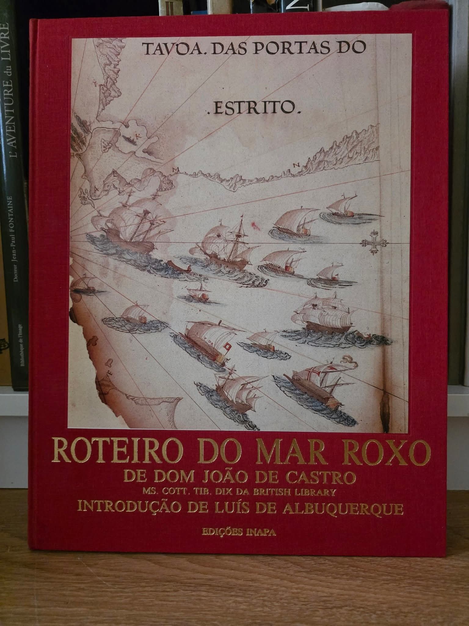
🔵 We picked up off the shelf the Roteiro do mar Roxo, a document from the shelf the Roteiro do Mar Roxo, a formidable document about the Portuguese military and exploration expedition led by Estêvão da Gama to the Red Sea in 1541. Dom João de Castro records in detail the geography, ports, anchorages, fauna and navigation conditions of the region. The manuscript is in the British Library and is certainly one of the most valuable in Renaissance cartography and Nautical Science. Our attention is drawn to Bab el Mandeb, [now once] again at the centre of international news. The Bab el Mandeb or ^Gate of tears^, perhaps on account of the dangers and shipwrecks that occurred there, is a vital point of trade between the West and the East, so the Portuguese had already come to know it quite well, since the sixteenth century. Although the roadmap is essentially focused on the entire western part of the Red Sea, the information regarding the present day Houthis, i.e. the Zaidi Shiites, had already been addressed by Afonso de Albuquerque in his letters. The Zaidi Shiites were allies of the Portuguese, given the excellent relationship that bound us to the Safavid dynasty of Persia, so, unfortunately, the expedition did not establish contact or transmit any information about these populations.
《Portas do Estreito [The Strait's Doorway] exhibition —
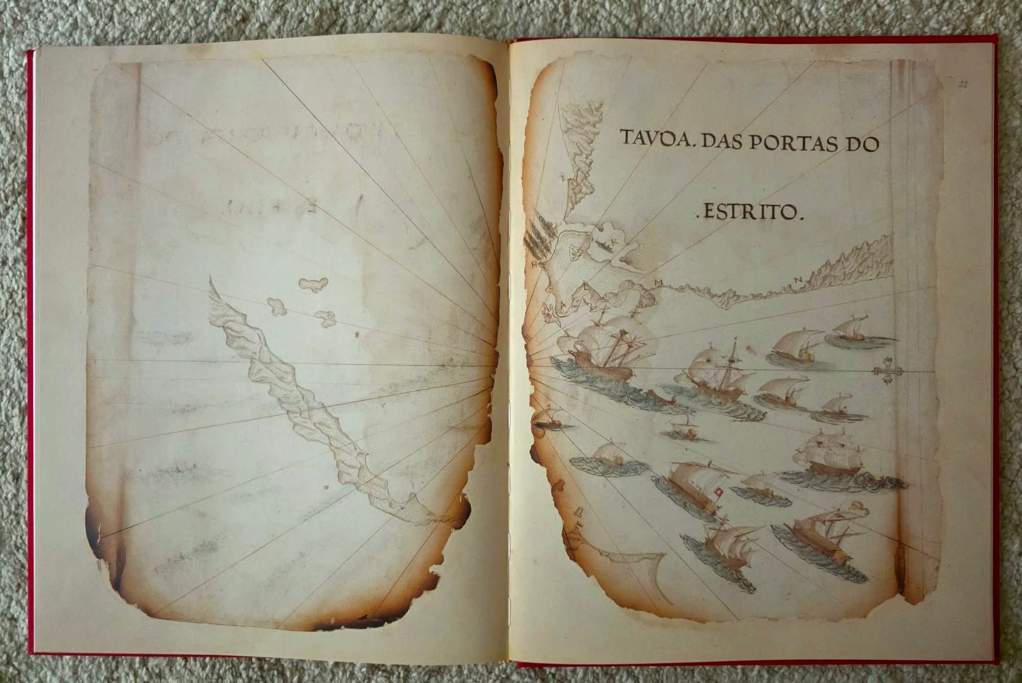
The thick and long point that goes out to sea at the gates of the Strait, in the land of the Arabian, shall be A, E ; the islet of Robões, which is on the face of this point, B ; the island, which is a league off into the sea from this islet, meets the coast of the Abexim, shall be C ; and its harbor, which is opposed to the coast of the Abexim, D ; the channel's narrowest space, properly called the gates of the Strait, is the interval that goes from B to E, which shall be nearly a league. The Promontory [see note 1 below] , which is in the land of the Abexim at the gates of the Strait and is opposed to Possidium [in note 1 below], let us call F ; and the cove which is within the gates let us view as an H ; and I [being] the low and long point between which, and the point of, the Stones H, [wherein] lies the cove for anchorage and shelter of rising *Levante" winds [East winds - see note 2] . Also, the large and round lagoon into which the galleys may enter and remain [rest], is shown as K ; but the great and mighty Hill that overlooks the promontory of Possídio [Possidium], which makes a notable landmark to those coming in from the sea, is L ; and the plain that runs from this place all along the sea until it meets the [mountain] ranges that come from Aden, shows us the letters M and N 》
Note 1 : part A)
Relating to Roteiro do Mar Roxo: This 16th-century Portuguese pilot book. ⤵️
Promontory (a quick definition)
— The Red Sea / Bab-el-Mandeb Promontory: Used by classical geographers and translated in historical pilot books like the Roteiro do Mar Roxo to denote a prominent cape on the Arabian side of the southern Red Sea/Strait approach near the historical Pilot Islands.)
Part B)
To help clarify. "Possidium" (or "Possideum" ) was indeed an ancient geographical term, it referred to multiple different locations — and not a single landmark in itself.
It was a common name for several places in the ancient world, nearly all of which were capes, promontories, or coastal towns.
It's a geographical/navigational term for capes and anchorages mentioned in classical texts.
Note 2 : (As I must go out, I shall come back to enter - edit - this translator's note)
(From the original text)
Retiramos da estante o Roteiro do Mar Roxo, um formidável documento sobre a expedição militar e de exploração portuguesa liderada por Estêvão da Gama ao Mar Vermelho em 1541. Dom João de Castro regista com detalhe a geografia, os portos, os fundeadouros, a fauna e as condições de navegação da região. O manuscrito encontra-se na British Library e é certamente um dos mais valiosos da cartografia e da ciência náutica do Renascimento. Prende-nos a nossa atenção o Bab El Mandeb, novamente no centro dos noticiários internacionais. O Bab El Mandeb ou Portão das Lágrimas, talvez pelos perigos e naufrágios ali ocorridos, é um ponto vital do comércio entre o Ocidente e o Oriente, pelo que os portugueses já o conheciam bem desde o século XVI. Muito embora o Roteiro seja essencialmente focado em toda a parte ocidental do Mar Vermelho, as informações referentes aos atuais Houthis, ou seja, aos xiitas zaiditas, já tinham sido abordadas por Afonso de Albuquerque nas suas cartas. Os xiitas zaiditas eram aliados dos portugueses, dada a relação excelente que nos prendia à dinastia Safávida da Pérsia, pelo que, infelizmente, a expedição não estabeleceu contacto nem transmite qualquer informação a respeito destas populações.
«Mostra das Portas do Estreito
A ponta grossa e comprida que sai ao mar nas Portas do Estreito, na terra do Arábio, seja A, E; o ilhéu dos Robões, que está no rosto desta ponta, B; a ilha, que está uma légua ao mar deste ilhéu, encontra a costa do Abexim, será C; e o seu porto, que se opõe à costa do Abexim, D; o mais apertado espaço do canal, a que propriamente chamam as Portas do Estreito, é o intervalo que há de B para E, o qual será quase uma légua. O promontório, que está na terra do Abexim nas Portas do Estreito e é contraposto a Possídio, seja F; e a enseada que está dentro das portas nos amostre H; e I a ponta baixa e comprida, entre a qual e a ponta das Pedras H, jaz a enseada onde é o surgidouro e abrigo dos ventos levantes. E a lagoa grande e redonda, dentro da qual podem entrar e estar as galés, se mostra por K; mas o outeiro grande e poderoso que está sobranceiro ao promontório Possídio, que faz notável amostra aos que vêm de mar em fora, será L; e a planície, que vai correndo deste lugar, ao longo do mar, até encontrar as serras que vêm de Adém, nos amostram as letras M e N.»